
Overview of HM Land Registry title plans and their features
Land Registry title plans are a crucial document in commercial properties for officially recording the details of a property and ensuring the property’s rights are accurately documented. Since 2003 it has been law for the plan to be compliant with the Land Registry guidelines. A plan comprises of a detailed scaled drawing that outlines the specific area of the property or premises being included in a transaction. In a commercial property, the title plan can often break down specific areas of larger buildings or complexes which are being sold or leased.
Title Plan Submission
The Land Registry requires the submission of a title plan in various situations, including:
• Registering a property for the first time.
• Since 2003 it is the law that any new lease longer than 7 years must be registered.
• Transferring the ownership of a property.
• When dividing a property into multiple plots.
• May be required when applying for planning permission to show the exact location of the property.
For the plan to serve its purpose it must include several important features:
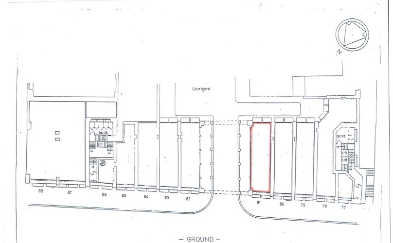
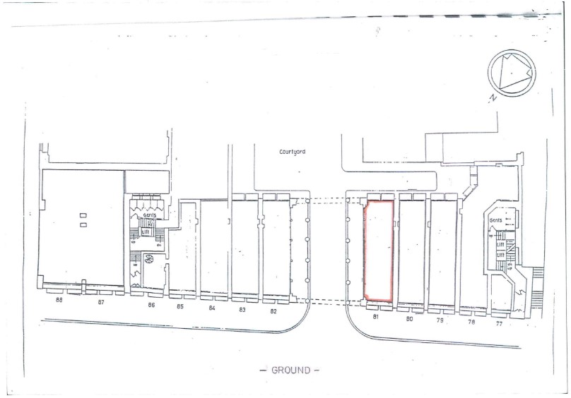
• Defining the Subject Area – The plan clearly defines the area of the premises subject to the lease. This can include office, warehouse and retail space, or other parts of the building or wider external areas that the tenant is taking control of.
• Measurements and Scale – The accuracy of the plan can be crucial in disputes and denoting the lease area in terms of its floor space. This can also be important in calculating business rates for the property. The preferred scale of the drawing is often 1:1250 or 1:500 for properties in urban areas and 1:2500 for properties in more rural areas. Each plan must show sufficient detail so it can be identified on an Ordnance Survey map.
• Orientation and Level of the Property – The plan should clearly show the orientation of the property, typically north, to help further identify it. The level of the property should also be noted which is especially important when the property covers several floors.
• Common Areas and Rights of Way – Coloured lines are used to detail the leased area and any areas shared by multiple tenants, such as hallways and car parks. Rights of way must also be clearly defined on a land registry-compliant plan. There are no specific colours required on the plan, however, it is common for red to denote the leased area and blue or brown to identify communal areas and rights of way.
In summary, a title plan provides a visual representation of the areas of a property. It documents important features and plays a crucial role in defining and documenting the sold or leased space, and as a legal document can hold up in a court.
Figure 1: Example lease plan
DISCLAIMER: This article is for general information only and not intended as advice. Each project has its own set of unique circumstances, all potential issues should be investigated by a surveyor on a case by case basis before making any decision.